Discovering the lost manor of Højby, Central Jutland, Denmark
Rainer Atzbach, Morten Gregersen and Henrik Kokborg
Many early modern manors are rooted in late medieval castles. In 1674, the new manor Gersdorfflund was formed from the older estates of Porsborg and Højbygård. While Gersdorfflund still exists today (although the current buildings were erected in the 1840s), the two older estates have disappeared. Of particular interest here is Højby, alias Hojbygaard, which once lay between Odder and Hou, remote from the main road. The manor was first mentioned in 1386 as ‘Howby’ and belonged to Niels Knudsen, whose half-brother Bent Puder called himself ‘of Højby (“til Højby”)’ in 1406. Between 1408 and 1483, the bishopric of Aarhus inherited and bought several shares of the estate, which were probably administered by the bishop’s manor in Åkær. Another share passed to Jørgen Rosenkrantz, who gave it to the Crown in exchange for other estates in 1559. The Crown had also held the episcopal shares since the Reformation. Until 1662, Højby was in undivided royal ownership and was used as provisioning for discharged officers. Finally, the manor was torn down, and its estates were united with the fief of Åkær to form the new manor Gersdorfflund, which Rigsdrost Joachim Gersdorff received in exchange for his lost estates in Scania.

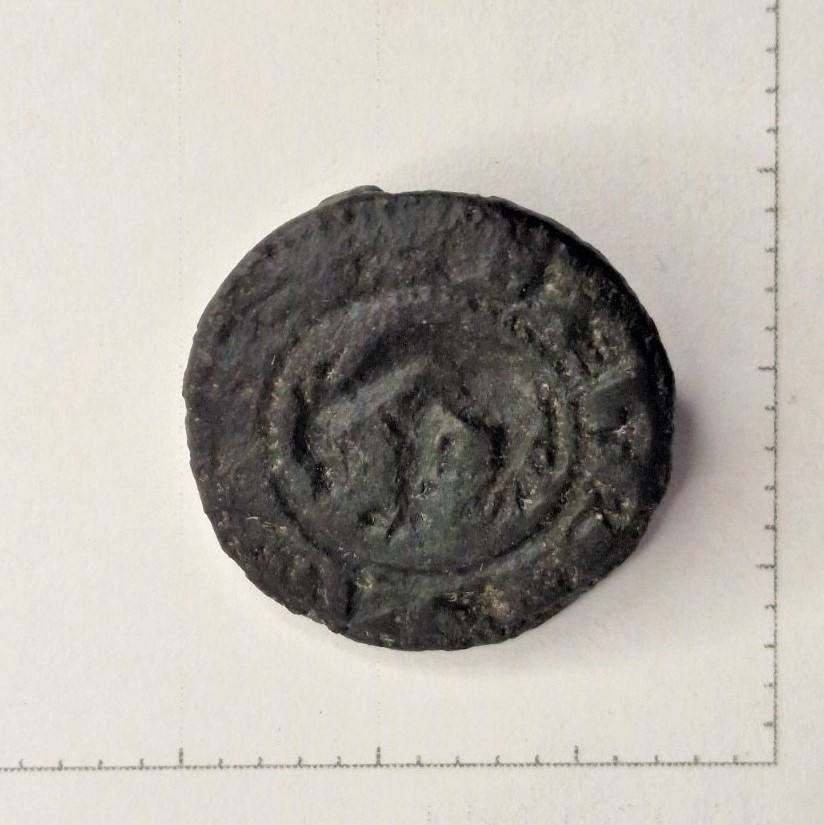
Medieval signet of Kalf family showing a kalve, signet view. Photo: Henrik Kokborg.
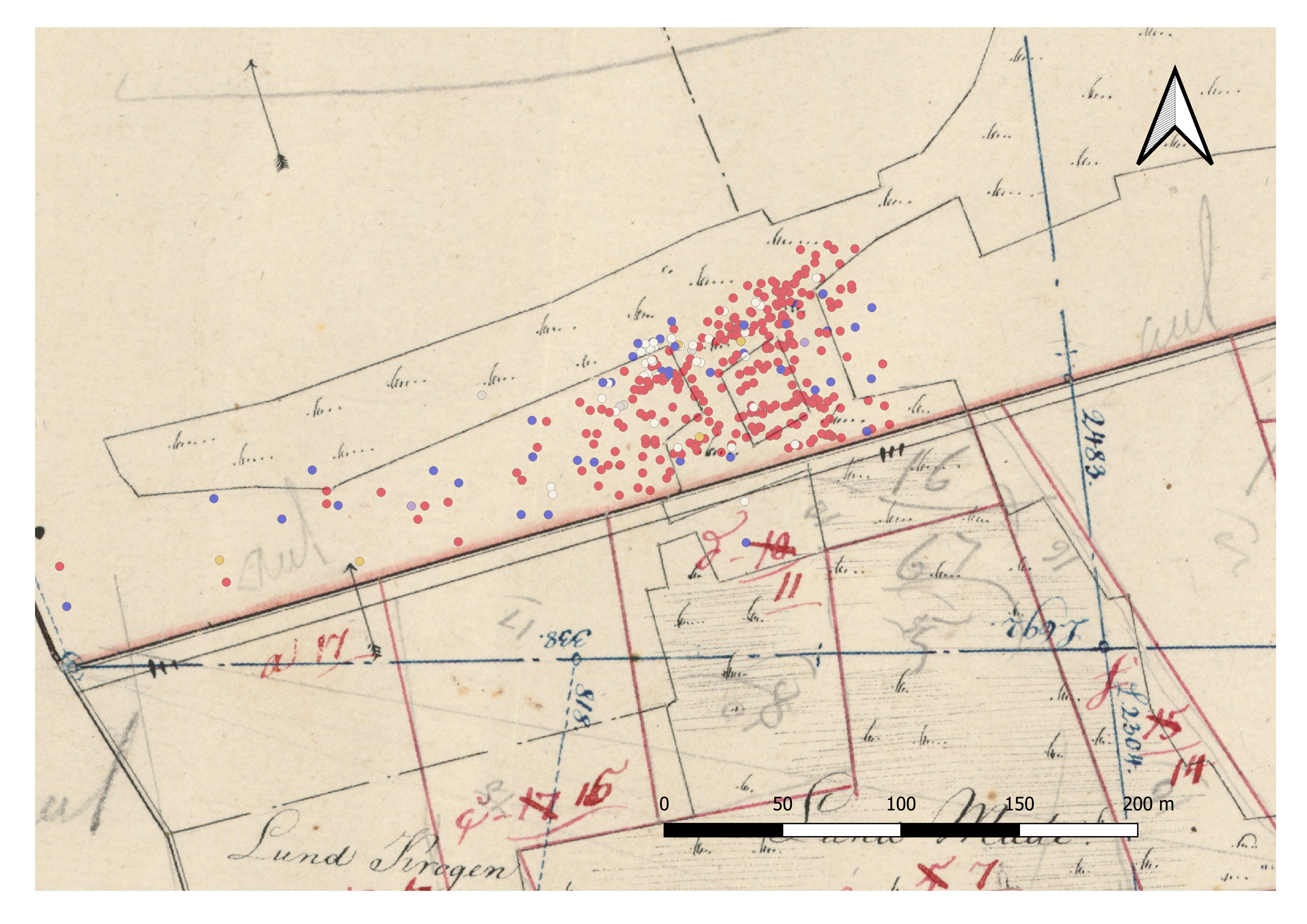
Since 2021, intensive inspections of the castle site by detectorists have uncovered numerous metal finds (coins, pieces of jewellery, belt buckles and shoe buckles, see Kalf family’s signet (Fig. 1), which indicate that the site was in use from the late 13th/ early 14th to the 17th centuries. This close cooperation between volunteer detectorists and the responsible heritage authority, Moesgaard Museum, also resulted in the exact localisation of the lost manor and its extension. The Department of Archaeology and Heritage Studies at Aarhus University plans to excavate parts of the site in collaboration with the museum and the detectorists as part of its bachelor programme in archaeology in spring 2025. In preparation, the first-year students carried out a field survey on site on 6 September 2024. Ceramic shards, bones and, above all, numerous brick fragments were mapped over a large area using MuseumsGIS. The distribution of finds did not only correspond well with the objects found by the detectorists, but also with the depiction of the former manor on the oldest cadastral map from 1797 (cf. Fig. 2). It clearly shows the manor’s core as a slightly distorted rectangle of about 27 x 37 metres. To the north and south, the site was protected by extensive, natural wet lowlands, while impressive artificial moats secured the western and eastern sides.

The oldest cadastral map drawn in 1797. In its centre the distorted square of the castle site with mapped finds: red=brick fragments, blue = pottery, white = bones/teeth, orange= iron Graphic: Rainer Atzbach, background map Dataforsyning – Historiske Kort på Nettet.
The location in a wet lowland, remote from the road between Odder and Hou, resembles numerous other Jutland ‘bog castles’, which were built as a retreat for their aristocratic owners, especially in the uncertain times of the 14th century. The forthcoming excavations will intend to investigate the inner structure of the complex – the brick distribution registered during the field survey indicates several buildings. In addition, the wet subsoil of the moats is expected to yield numerous organic finds, which could also contribute to a more precise dating. Højby will thus provide a direct insight into the early days and everyday life of a Danish manor house.
For further information contact Rainer Atzbach: rainer.atzbach@cas.au.dk

Medieval signet of Kalf family showing a kalve. Inverted view as seal. Photo: Henrik Kokborg.